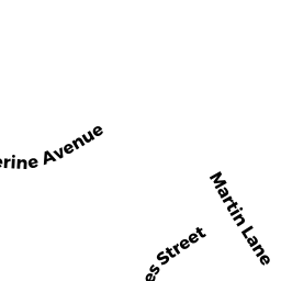
110 MARTIN LN
Owner Information
DOLAN, EDWARD K JR
110 MARTIN LN
WRENTHAM, MA 02093


Property Details
110 MARTIN LN is classified as a Single Family Residential (Colonial).
The primary structure on this property was built in 1990. There are 4,614ft2 of built area within this property. There is 2,550ft2 of residential/living space within this property. This property is listed as having 8 rooms.
110 MARTIN LN is valued at $545,700. The land is valued at $222,900 and the structures are valued at $321,800. There is an additional valuation of $1,000 on this property.
This property is in Zone 01. Confirm with local Zoning Board authorities to ensure there are no overlays or other easements on this property.
The most recent deed for 110 MARTIN LN is recorded at the local registrar in Book 37301, Page 171. 110 MARTIN LN was last sold on Thursday, October 31, 2019 for $10.
Assessment data from fiscal year 2022.
Flood Data
This property is partially within the A Zone (within floodplain). Approximately 0.28 acres (28.03%) of the property is within this zone.
This information is sourced from the FEMA National Flood Hazard Layer. See our full disclamer.
Broadband Internet Providers
| Provider | Type | Bandwidth (mbps) | |
|---|---|---|---|
| Verizon New England Inc. | Fiber | 940 | 880 |
| VSAT Systems, LLC. | Satellite | 2 | 1 |
| HughesNet | Satellite | 25 | 3 |
| GCI Communication Corp. | Satellite | 0 | 0 |
| Comcast | Cable | 1000 | 35 |
| Viasat Inc | Satellite | 100 | 3 |
| Verizon New England Inc. | DSL | 10 | 1 |
Broadband service provider data from December 2020.
Adjacent Properties
- 239 SHEARS ST OFF
VACANT LAND DEV V owned by FIRST PORT INC - 60 MARTIN LN
Single Family Residential owned by SMITH, JOSEPH - 80 MARTIN LN
Single Family Residential owned by HARVEY JOHN V & LYNETTE J - 90 MARTIN LN
Single Family Residential owned by FITZPATRICK, JAMES R - 100 MARTIN LN
Single Family Residential owned by SOLOMON ROBERT J